3D Velocity Field From L-Band InSAR Reveals Multi-Scale Tectonic and Non-tectonic Deformation in Northern California
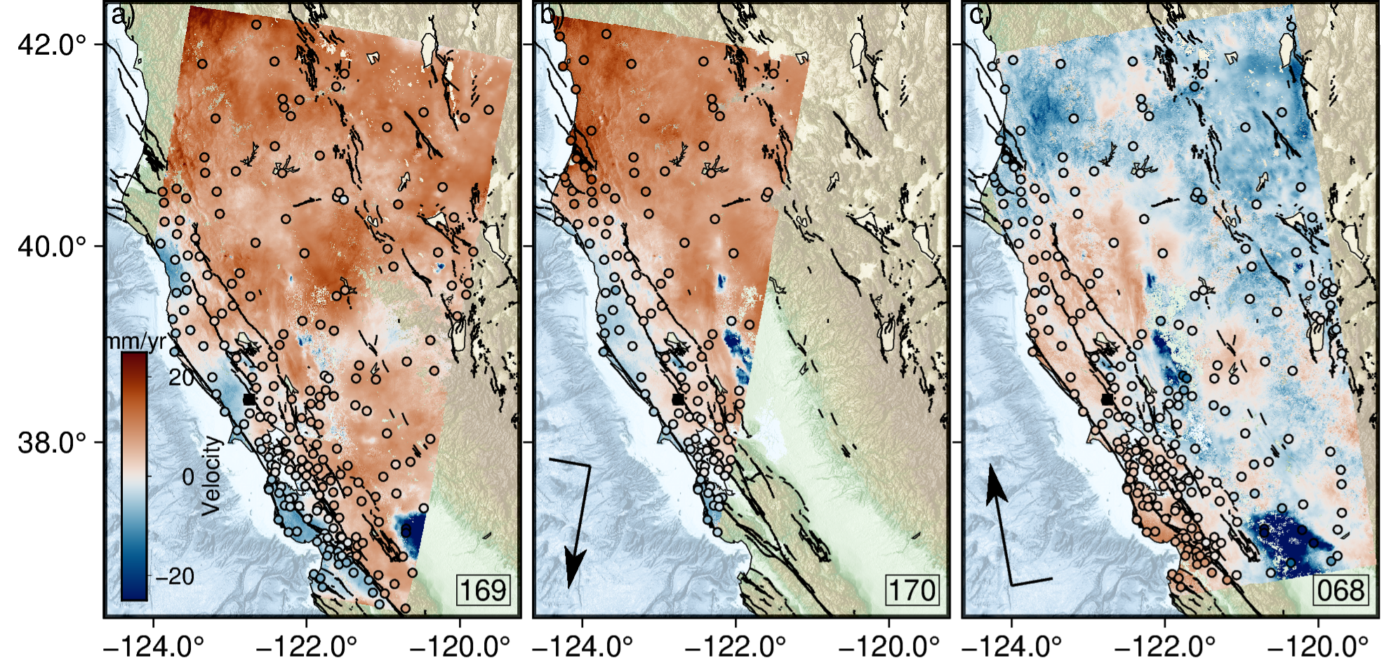
We utilize L-band InSAR data from the ALOS-2 satellite to capture surface deformation across Northern California from 2015 to 2024. Our analysis spans a range of spatial scales, from slow-moving landslides to regional tectonic processes around the Mendocino Triple Junction. By validating InSAR observations with GNSS velocities and time series, we establish a robust vertical velocity field and address challenges in long-wavelength deformation detection. Our new vertical velocity field encompasses the region north of San Francisco to the Oregon border and nearly the width of the state. Our observations revealed significant aquifer subsidence in 2022 during the last year of record drought, subsidence at the summit of Medicine Lake Volcano, and seasonal landslide acceleration. This chapter highlights L-band InSAR’s ability to maintain coherence in vegetated regions and detect subtle seasonal deformation, laying the groundwork for future observations with the upcoming NISAR mission.